Showing posts with label Hiking. Show all posts

Sunday, June 18, 2023

Elk Falls


Although many hikes or walks are just a chance to get out and enjoy the outdoors in the natural elements in the area you are visiting, It is nice when you have an attraction to look forward at the end of the trail. Our hike to Elk Falls was one of those, with the anticipation of a spectacular waterfall and a suspension bridge our goal. 


You can always tell when a waterfall is going to be a good one when you start hearing it well before you can see it, and this was very true of Elk Falls. Well before we arrived at the falls we could hear the roar of the falling water. 

Historical photo of the wooden pipes


The trail to the falls leads through typical BC forests with the tall trees we have enjoyed on the previous walks, and across a construction site where old wooden Penstock Intake pipes which once carried water from the lake down to the hydro plant had been replaced with underground modern pipes. Pictures of the original wooden pipes show how impressive they must have been. The trail then entered a heavily wooded area with some huge trees and started sloping down to the waterfall, which although clearly heard was still a long way off. The trail switched back and forth down the hill until we finally reached a viewing area where you could see the falls still a distance away. The trail

Lots of stairs

then became a series of steep metal steps to get down to the top of the gorge where a nice modern steel suspension bridge crossed the gorge. There was a viewing platform before the bridge where the falls could be seen, but the best viewpoint was from the middle of the suspension bridge hanging over the deep gorge where the water plunged down into. When you walk across the bridge to the viewing platform at the other end where you can’t actually see anything you realize that the best views are from the bridge itself. 


The location of this lovely waterfall makes it very difficult to actually get a good view, so the BC Hydro have wisely built the suspension bridge to make viewing safer for the public. The gorge the water lunges into is steep and deep, and apparently tourists have slipped and fallen to their death in the past trying to get a better view of the falls. My Nova Scotian friends will be familiar with this situation in our famous Peggy’s Cove lighthouse rocks where the same thing has happened many times. 


Elk Falls Provincial Park surrounding the waterfall has campground and many other hiking trails along the river and through the woods, and once we had our fill of the falls, we did walk a couple of kilometres of the trails, discovering massive trees that survived forest fires leaving them still growing but with blackened hollow insides large enough to walk into. 


Another wonderful adventure in the BC outdoors and no elk actually fell (As far as I know).


Sunday, August 26, 2018

Have You Been to Meat Cove?

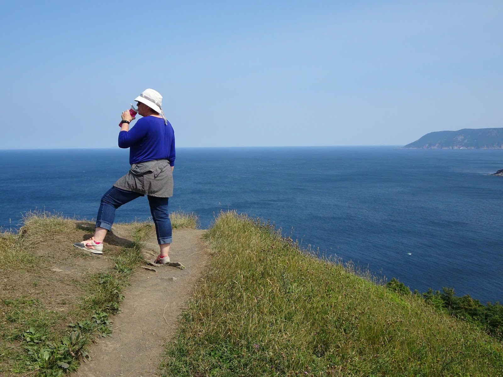
Meat Cove from he end of the trail

I knew where Meat Cove was, and drove by the sign for the road to Meat Cove, but in 50 years of living in Nova Scotia I have never made that turn and actually drove to Meat Cove. This year while spending a week in Cape Breton, I finally visited this community.

According to Wikipedia, Meat Cove is a fishing community located at the most northern tip of Nova Scotia. I discovered that this is partially true . . . .

The road to Meat Cove branches off from the Cabot Trail at Cape North and is very much a “Secondary Road”. It twists and turns up and down through the highlands along the coast. Starting out paved it becomes dirt than paved then dirt then paved and finally dirt into the community. In places there is a shear drop off the hillside with no guardrail on the side of the road. Although the road does not actually “end" in Meat Cove, it deteriorates into a rutted washed out track requiring more ground clearance than my Camary provided.
Beer & Seafood at the Chowder House


Although Wikipedia called this a “Fishing” community I would say this was more history than current fact. There was no fishing wharf, no boats and no fishermen. There is a campground perched on a cliff and a restaurant along with a few houses and that is about it. There is actually little evidence that there was ever much more there; if fact, the cove is so small there is not room for much more. Listings say there are 65 residents, but that must include people living on the road into Meat Cove.

Regis taking in the views
The fact that there is little here did not seem to matter on the day we drive to Meat Cove; arriving at the end of the road we had a difficult time finding a place to park to have lunch at the little Chowder House restaurant across from the campground, there were that many people here.

After a delicious lunch, we took the server's advice and followed a unmarked but well used hiking trail to an elevated headland which gave a wonderful view back over the area as well as both the Atlantic Ocean and The Gulf of St Laurence.

Then we walked down into the cove itself to discover a beach covered with Inukshuks. It looked like all these little statues I saw on this summer's drive to Lac Seul had been magically transported here to Meat Cove. Leaving the cove I discovered another hike this one a boardwalk along the river leading down to the cove. I took the hike while Regis went to retrieve the car.

BUT, I'm still not sure why it is called Meat Cove?
Wow Inukshuks Here in Cape Breton


Tuesday, November 15, 2016

Bushwalking


Ready to go Bushwalking
Our first full day in Australia and we had to do something “Australian”. Since it is spring here and the temperature was expected to go up to 25°, our first choice was to go to the beach, and have lunch of Chicken-salt French Fries on the beach for lunch, but Steph, Regis’s niece came home and changed the plans, suggesting we go Bushwalking and then go to the beach.

Great Views
Here in Australia you do not go to the “woods”, you go to the “bush”, and you don’t hike, you “Go for a Bushwalk”. Now they do use the same term for the trails as in New Zealand, and we headed for the Wyrrabalong (Pronounce that “Where I Belong”) National Park Track. This is an interesting park, situated between a residential neighborhood and the steep ocean cliffs, so although a beautiful natural site, it is conveniently close to the city so people can use it easily. There was a nice parking lot at either end, and the track itself was well maintained and easy to walk on with sand underfoot and stairs on the climbs. As you “Walk” the track you come out onto beautiful look-offs with spectacular views all the way to Sydney from cliffs that are shared with para-gliders and hang-gliders launching out over the ocean. Fortunately no one was taking advantage of the updrafts and we had the cliff to ourselves.

Time for Chicken-salt French Fries
Hiking through the woods, or “Bushwalking” in Australia is so different than in Canada, because the vegetation you walk through is so completely different from what we are used to. No maple trees, no oak, and no pine or spruce. There were Banksia, Gum trees, and paperbark trees. It is really weird, It was like walking through a completely different landscape. Even in Asia or Europe there are trees I recognized, but here on a continent not connected to anything else, a completely alien world has developed. The trees are different, the flowers are foreign, everything is new. As I walked along I was constantly stopping to photograph plants and trees I had never seen before.

We still got to go to the beach only it was even nicer after a long bushwalk and those chicken-salt French fries were even tastier.
Termite Nest


Wednesday, November 9, 2016

Tracking the Higher Ground


A Nice "Track"
In New Zealand they speak English, but you have to be careful, because it is not always the “English” that you are used to. I think that once they got so far away from the home of “English” they decided to tweak the language to their tastes.

There are many examples of words that have taken on slightly different meanings down under. The one that I noticed was the word “track”. Down here it means trail, as in hiking or walking trail. Regis and I have been making good use of the New Zealand tracks during our explorations.

We have always enjoyed walking and hiking, and when on the cruise ships, I have often looked out from the ship and seeing a high point on the land, think, “That would be a good spot to get some pictures.” As a result, we often find ourselves searching out trails leading up to these high points of land. Here in New Zealand these trails are often called “tracks”. We have found a few of them.

Instead of purchasing the high priced Ship Approved Excursions, we often just walk off and explore on our own, and often on these self-guided tours we find these New Zealand “tracks” calling for our attention. They have proven to be very worthwhile side trips.

Our first “track” was in Hawaii, where we hiked up to the top of Diamond Head, but I already
A Great View!
told you about that, and on Hilo, (Still Hawaii) we hiked to the Akaka Falls. On Pago Pago we tried to find the trail to a National Park, but never found it. On Dravuni Island in Fiji, we hiked to the highest point on the mountain for terrific views over the whole island. In Easo Lifou, New Caledonia we found a track up to a lovely little church on a cliff overlooking the island. In Noumea, New Caledonia, while walking around the town I discovered stairs leading to a track again up to a high point giving another excellent view of the town.

Once we reached New Zealand we discovered that what we were doing was following
Climbing in "Stile"
“Tracks”, and I already told you about the great tracking we did in Port Chalmers, where we found two tracks that kept us from visiting Dunedin. Then in Akoroa after a morning exploring the town we found a track leading up a hillside occupied by “Haggis on the hoof” where we found another Noordam couple enjoying the beautiful view over the town’s harbour.

Switchback to get to the top
By this time we were really getting into this “tracking” around, and in Picton, New Zealand we headed directly to a marked track that led up a mountain to look-offs and down to Bob’s Bay, named after a man who created this track by hand many years ago. This was probably the longest track we took and led to fantastic views out over the area. Wellington had wonderful views but we took a tour and the bus took us up the ‘Tracks”, and although we had a track all mapped out in Napier, we ended up in Jail (Just a tour; don’t fret!).

It was worth the climb
By the time we reached Auckland, we were ready for some easier tracking and I was only too happy to allow my cousin and her husband to drive us up the tracks to get the views over Auckland.

However, after all our tracking over the South Pacific Islands, I think we managed to counteract the wonderful meals on the cruise ship . . . . our clothes still fit.

Thursday, October 6, 2016

Climbing Into a Volcano


At Diamond Head
Now I admit that the title is a bit dramatic . . . We actually visited Diamond Head State Monument but 300,000 years ago this crater WAS formed by a volcanic eruption. This site is the most recognized landmark in Hawaii, and was designated a National Natural Landmark in 1968. During the war the strategic location and panoramic views of the surrounding area from of the crater walls made this an ideal location for island defense, so observation posts, gun emplacement, and fire control stations were installed.

The infrastructure built by the military provided the basis for the current facility. There is a 1.3 km hike up the crater walls to the top. Although not a long hike, it involves a climb of 560 ft, 173 steps up, a 52 step circular staircase climb, two tunnels (one 225 ft long), and then 82 stairs back down to the original trail. All this is connected by a steep switch-back trail up
Through the Tunnel
the crater wall. All of this is part of the original military installation.

The trail is popular. There was a steady stream of people making the climb to the 761 ft observation tower area. There were at least three school groups and hundreds of tourists in a steady line all the way up and down the hike. We were properly outfitted for the adventure, with good shoes, hats and water, but there were many people struggling up the slippery trails in flip-flops or dress shoes, and I saw one woman in heels. It was a sunny hot day, with 28° temperatures and many people did not have water with them. I was surprised at how easy I found the climb. I listened to people huffing and puffing and breathing hard where I was fine; I guess I am in better shape than I thought. My knees were feeling it on the way down, but I found it a very pleasant morning adventure.
Wear Appropriate Footware?

I do think we will take it easy the rest of the day however.

Wednesday, September 12, 2012

All Alone in St. Pierre

We went out for dinner on the first evening here on St. Pierre. The restaurant was right around the corner, one of many in the town within walking distance of our hotel. There was no one in the restaurant, except the server and us, but we were early so I didn't think anything of it, especially since the chef walked in dressing his street clothes a few minutes later. I could almost imagine the server slipping into the back room after seating us and calling his home . . . "Some crazy English tourists are here for dinner; come quick!". It did get a little better later, with a young couple dropping in for drinks and another English couple for dinner, but that was it. On the upside, we did chat with everyone there - you can't do that when the restaurant is full.

Leaving the restaurant at about 8:00 pm we exited to empty streets. Not a person anywhere; not a car on the streets; complete silence. It was like aliens had beamed up the entire population. We walked back to the hotel in complete and utter silence. We met no one, and heard nothing but the wind. It was odd, and a very little bit eerie, but we figured that there was a hurricane bearing down on this little French colony, so perhaps everyone was hunkering down indoors. We were told the next day that it was the day before school started, so everyone was home early getting ready for an early evening. WOW, in the cities I'm used to, the teenagers would be out for one final night of freedom before a year of school. Talk about culture shock! I should have been teaching here.

Overnight the hurricane came and went, leaving the island relatively unscathed, so when the sun came out at 10:00 we set out for a walk. Eventually we found a paved road leading out of town into the hills and decided to explore. We were gone for over three hours and saw one car and met no one on the road or the trails through the hills. That evening we tried another restaurant, this one with lots of people, but again when we left to walk back to the hotel we were presented with a dead empty town. Not one person on the streets and we walked through a silent town.

The next day we decided to explore the town and discovered that indeed there were people who lived here and the streets were busy and full of people. There were cars, buses, tractors, construction crews, and lots of people on the streets and boats moving in and out of the harbour. The town was actually alive! BUT . . . . . 12:00 noon arrived and everything stopped. Really;  everything completely stopped. The town went silent. No people on the streets, traffic stopped. the streets were dead! We walked back to the hotel past closed shops and empty streets. We were once again alone in St. Pierre. Looking at the signs in the shops we realized that everything shuts down from 12:00 to 2:00, and they really do shut down. It is very weird to suddenly have an entire town go so completely silent. It seems that the same thing happens in the evenings. No "Night Life" here, they roll up the sidewalks and go in for the evening.

I have learned to adapt, and I'm quietly writing this inside at the hotel at 1:57 pm, oh wait a minute I can hear the whole town waking up and coming back outside. Time to finish this blog entry.

Wednesday, June 6, 2012

Weir Fishing


Walking on the ocean floor
I usually write about my post retirement trips on this blog, and normally the trips are off in some far-off locations, but you know there are lots of interesting spots to visit and write about right here in my home province of Nova Scotia. This summer, I am not traveling far, and intend to make a few trips around the province. We are off on our first excursion early in June, picking up the trailer from dad in Elm River, visiting friends in Economy, and then going across to the Valley, and then around to tour the South Shore.

The Weir
Our first stop in Economy, gave us  a chance to go weir fishing. I’m not much of a fisherman, lacking the patience to stand around waiting for some fish stupid enough to get my fish hook stuck in its mouth. Weir fishing makes it easier. They go out onto the flats at low tide and set up poles and nets in a “V” so that the next time the tide goes out the fish are funneled into the “V” and into a large square net.

We walked out across the Bay of Fundy following the tide as it went out. The owner of the weir came out in an old truck (they only last so long driving through the salt water), and unloaded empty plastic fish boxes and lent us all rubber gloves.

The weir was full of fish, but four were large sturgeon that as a protected species had to be released. These things were big enough that they had to be pulled out to deeper water with a rope.

Letting the sturgeon go
We filled about eight tubs with flounder. You could stand inside the weir, and just bend down and pick the fish out of the water. The fish were four or five deep underfoot, and all you had to do was feel around in the water to find another fish to throw into the bins.

Although this is an easier way to fish than casting a baited line into the water hoping for a bite (we tried this the next day with NO success), after an hour of throwing flounders into boxes, I decided this wasn’t that “easy”. The couple who were actually catching these fish for a living were only starting - they still had to take the catch home and clean and process it for sale, over another three hours work.

Regis didn’t make it any easier, she was constantly telling us that “that little one wants to get away.” or “oh look at that cute one; you should let him go.”

Monday, August 8, 2011

SNOW???????

Happy Hikers
My sister and her husband Pete share in an Alpine chalet in the Alpine Village on the top of Mount Washington on Vancouver Island. They rent it out to people from all over the world who come to BC for ski vacations, but it is rarely rented during the warmer months, so when we come to visit her in the summer it is usually available for our use. She has always told us about the amount of snow the village receives in the winter, but of course we only see it in the summer.

This year was an exceptional year for snow, we were told, and the chalet next door was heavily damaged by the weight of the snow, and there was even a patch of snow on the road leading into the chalet. I was not expecting the amount still in the woods however.

After the excitement of the wedding, and the cleanup afterwards, Linda had a nice hike planned the next day. There is a very nicely maintained provincial park just down the road from the village, and on another visit, we had explored some of the extensive trail system in the park, so we knew what to expect. . . . .

Not at all. . . We had no sooner gotten into the mountain forests, and we ran into snow - lots of snow. There were places where the trails were still under six to eight feet of snow, and some places there was so much snow that you had to be careful not to loose the trail completely. You had to look for ends of the boardwalks, or clear sections of the trails. Other hikers often had strayed off the established trails so you could not always depend on following the footprints.

The snow of course was old, often dirty, and rapidly melting in the lovely August summer heat; there was just so much deposited over the winter that it would be a while before all the ground was exposed.

The melting snow also made for a much more challenging hike. It was wet and slippery, and the run-off from the melting snow had often carved out large caves under the snow that threatened to collapse if walked over. You could see footprint shaped holes where other hikers had fallen through.
A Snow Cave

The unexpected snow made the hike more interesting and certainly more challenging. The nine km distance seemed longer with the care that had to be taken navigating over the snow. My hiking stick (a new piece of hickory picked up in Branson Missouri) proved to be an essential tool to keep from slipping and sliding off the deep piles of snow, and my knees were complaining by the end of the hike.

Six feet of snow still in August . . . One more interesting adventure on our trip.

Friday, July 15, 2011

Ain't It Grand

The Grand Canyon
When we stared planning this trip, the one place that Regis wanted to see was the Grand Canyon, so it was set as our goal as we worked our way across the United States. It was as far south as we would go on this trip.

We had a terrible time getting information on the Grand Canyon. We did not know the best way to get there, we did not know what to expect when we got there, and we were not sure if we should camp close, or camp in a nearby city and drive to the canyon. We stopped at the Arizona welcome centre, and the extent of the help we got there was being handed various brochures. When we asked about routes to drive to the canyon we were told to go a particular way because she felt traffic on the route that followed the south rim would be like rush hour. "30 miles of 30 mph driving", she warned.

We elected to stay in Flagstaff, Arizona for two days and spend the one full day at the canyon with the truck. We ignored the Welcome Centre's advice and drove the "busy" south rim route. We were the only car on the road at times, and had no backups or congestion, and there was always lots of room to park at the scenic overlooks. This route takes you straight up to the canyon, and then snakes along the southern rim of the canyon, providing many spots to pull off to look out over the canyon and take pictures.

At one point a sign warned that there could be mountain lions for the next 15 miles. Then, about two miles further there was a picnic area with a family happily eating. Does this really make sense? Didn't these folks realize that in a "mountain lion" zone, the picnic area, was for the lions, and they were the picnic . . . . Don't these people read the signs?

The Colorado River
The Grand Canyon is one of those "Must See" attractions, and there are so many pictures of it, that you have a preconceived idea of what to expect. It is actually exactly what we expected, and was every bit as spectacular as we expected. There are so many different layers of rock and it is just so huge that every stop provided something different to see. At one point we saw a sheer cliff to the bottom, another we could see the rapids on the river below, and on one stop we saw California Condors gracefully soaring above the canyon. The canyon changes by the hour, and the views over the canyon are different in the morning and afternoon, and although we did not stay to watch the sun set over the canyon, we were able to see how the lengthening shadows made particular rock formations stand out and certain colours become dominant. I took my camera with nice fresh batteries, and lots of room on the memory card, and I took hundreds of photos, but it is very hard to capture the grandeur of the Grand Canyon.
At The Grand Canyon

We knew what to expect; I can only imagine what early explorers or pre-internet vacationers must have felt coming across this incredible landmark for the first time. It is aptly named, and really is "Grand". Put it on your "bucket list".